


Storm Watch: Rain and flood danger to continue through Thursday


(Graphic by Solano NewsNet)
The worst of the winter storm that blew through Solano County earlier this week may be over, but the possible after effects may still have yet to be realized.
The National Weather Service is keeping in place a Flash Flood Watch for the LNU Lightning Complex wildfire burn scar through Thursday afternoon, warning that a copious amount of rainfall over the last few days coupled with damage and loosening ground from the fire could result in ash and debris slides in parts of rural Fairfield, Vacaville and Winters.
“Heavy rainfall over the Hennessey Fire in the LNU Lightning Complex burn scar is expected up to and during the period of the watch,” meteorologists with the National Weather Service said in a bulletin on Wednesday. “Residents near the Hennessey Fire in the LNU Lightning Complex burn scar should prepare for potential flooding impacts.”
The Hennessey Fire is the localized name for the wildfire that burned through rural parts of north Solano County last August. The wildfire was one of several to encompass the vast LNU Lightning Complex wildfire, which started in Napa County during a rare mid-summer lightning storm.
“Although [weather data] suggests rain rates are likely to remain below debris flow criteria, there is still a chance of isolated periods of heavy rainfall that could fall over the LNU Lightning Complex [burn scar],” meteorologists said. “Therefore, the Flash Flood Watch remains in effect through tomorrow afternoon.”
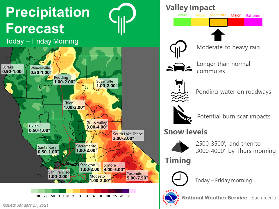
(Graphic by National Weather Service, Sacramento)
On Wednesday, officials with Solano County’s Office of Emergency Services said they were keeping in place an Evacuation Warning issued for parts of the wildfire’s burn scar. A warning is issued when there “is a potential threat to life and/or property” and offers residents and businesses ample time to prepare for a possible evacuation order, which would have more of an immediate impact.
In a social media post, officials directed concerned residents to a new webpage with the latest information on the winter storm. Additionally, officials say all residents — whether they’re in the burn scar or not — should sign up for Alert Solano, which is the county’s way of alerting people by phone, text and email to emergencies in progress, including evacuation notices.
Forecasters say the rain should taper off by late Thursday evening, with sporadic showers through the weekend.
Solano Wind Gusts Hit Near-Hurricane Speed
Tuesday evening and Wednesday morning’s wind storm brought some of the worst and most-damaging conditions experienced in Solano County in recent memory, with some wind speeds reaching near-hurricane levels in rural parts of the region.
In Denverton, the National Weather Service said a gust of 65 miles per hour was recorded on Tuesday around 11 p.m., just 10 miles per hour below what would be the minimal sustained wind speed for a Category 1 hurricane. Denverton is an unincorporated area located about 10 miles east of Fairfield.
Vacaville recorded the worst gust of the storm for an incorporated city, according to measurements from the weather agency, with observed wind between 45 and 55 miles per hour.
The following are 24-hour wind gust measurements recorded by the National Weather Service starting Tuesday at 7 a.m.:
Denverton: 65 MPH (Tuesday, 11 p.m.)
Vacaville, Nut Tree Airport: 58 MPH (Wednesday, 12:53 a.m.)
Vacaville, Cherry Glen Road: 51 MPH (Wednesday, 1:10 a.m.)
Elmira: 47 MPH (Wednesday, 1:58 a.m.)
Rio Vista: 46 MPH (Tuesday, 10:00 p.m.)
Vacaville, Blue Ridge Road: 44 MPH (Wednesday, 1:10 a.m.)
Vacaville, Pleasants Valley Road: 43 MPH (Wednesday, 1:10 a.m.)
Vacaville, Quinn Road: 42 MPH (Tuesday, 10:10 p.m.)
Dixon: 41 MPH (Wednesday, 2:00 a.m.)
Rio Vista Bridge: 41 MPH (Wednesday, midnight)
Fairfield, Clay Bank Road: 41 MPH (Wednesday, 1:40 a.m.)
Benicia, Dillon Point: 39 MPH (Wednesday, 12:04 a.m.)
Solano County had some of the highest wind gusts recorded during the winter storm, with similar breezes being observed in nearby Yolo County, according to National Weather Service data reviewed by Solano NewsNet early Thursday morning. But they paled in comparison to wind speeds recorded at Alpine Meadows in Placer County, where forecasters observed gust of a 125 miles per hour at the peak of the storm.


Storm Dumps Significant Rain on Solano County
Tuesday and Wednesday’s torrential wind was only part of the story: The winter storm that crossed through the region, which has been described by forecasters as an “atmospheric river” event, dumped a significant amount of rain — and, in mountainous parts of the county, a surprise dusting of snow.
Observed precipitation data reviewed by Solano NewsNet showed Fairfield received the most rain according to measurements provided by the National Weather Service. There, more than 2 inches of rain had fallen between Tuesday evening and early Thursday morning.
The following are observed precipitation measurements recorded by the National Weather Service from Tuesday at 7 p.m. to Thursday at 1 a.m.:
Fairfield: 2.14 inches
Elmira: 1.68 inches
Vacaville: 1.66 inches
Allendale: 1.46 inches
Denverton: 1.11 inches
Vallejo: 1.15 inches
Suisun City: 1.17 inches
Travis Air Force Base: 0.43 inches
Rainfall totals for Benicia and Dixon were not available, with the National Weather Service citing a lack of measuring stations in these cities.
We’re proud to produce independent news for Solano County. This newsletter is an all-volunteer effort. If you would like to show your appreciation, consider making a donation in any amount or converting your email subscription into a paid one.
Discuss this newsletter and other stories from across Solano County on our Facebook group here and follow our new Twitter account here.